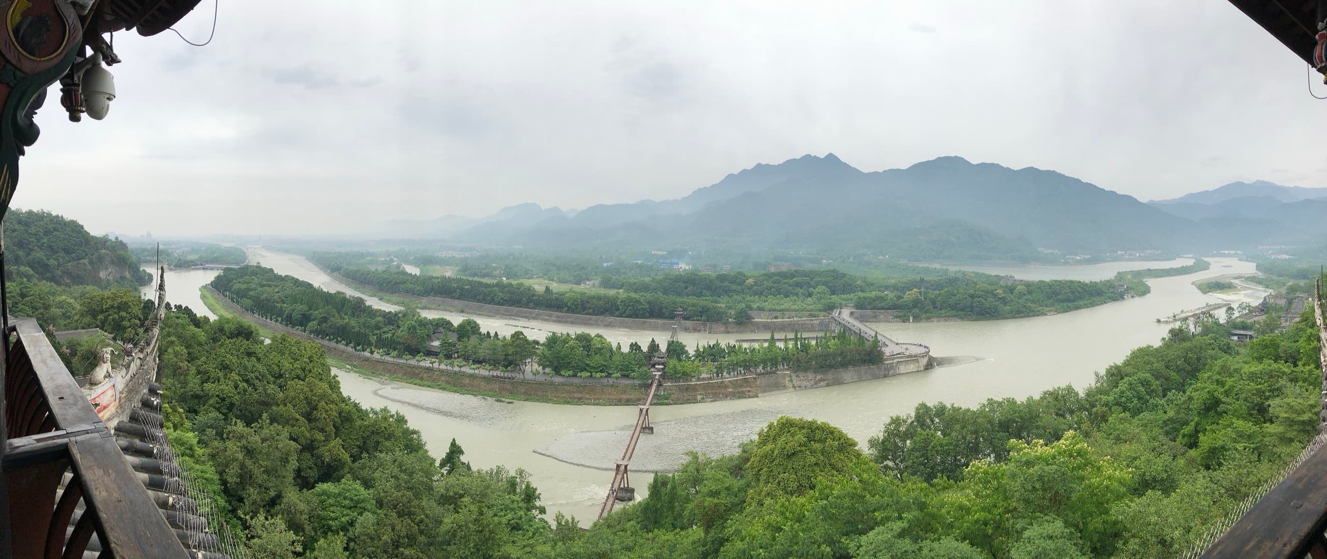
At Dujiangyan, the most important structure is the one a visitor may expect but does not find. There is no monumental high dam closing the Min River from bank to bank. The river keeps moving.
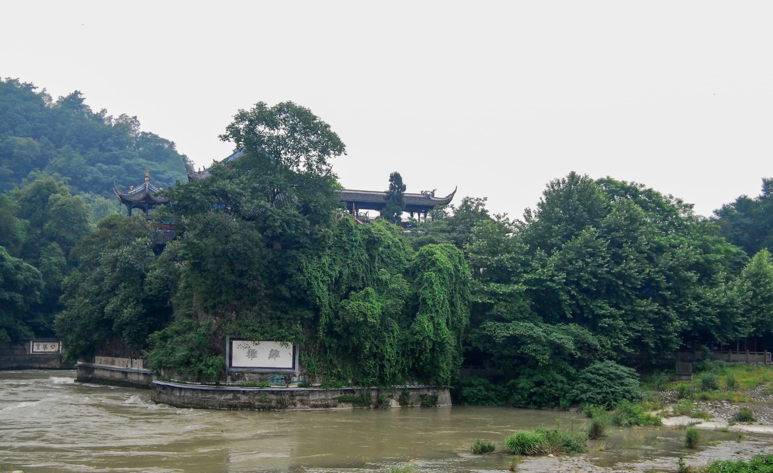
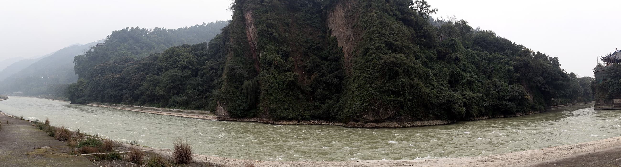
Near the head of the Chengdu Plain, a dividing work known as Yuzui — the Fish Mouth — separates flow into an Inner River and Outer River. The split can look effortless, as though water chose two directions by itself.
It did not. Channels, embankments, passages and terrain form a deliberately managed system. A reservoir dam stores water behind a barrier. Dujiangyan’s historic principle is diversion: part of the river continues along the outer course while part is guided toward the plain. The engineering begins with movement rather than opposition.
Where Mountain Water Meets a Plain
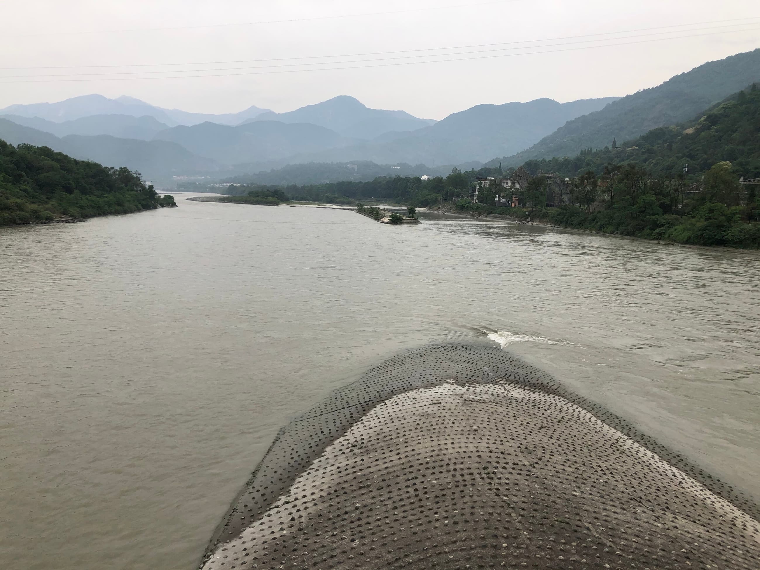
The Min River descends from mountainous terrain to the western edge of the Chengdu Plain. That transition brought water, seasonal flood and upstream sediment. Around 256 BCE, under Li Bing, governor of Shu for the Qin state, work began on what became the Dujiangyan system.
The landscape became part of the design. Elevation, current and river shape were used rather than erased. Later generations modified and enlarged the system, but the strategic decision endured: work with the river closely enough to redirect it.
Li Bing marks the beginning of the recorded project, not the end of its development.
Image: the Fish Mouth near the mountain-to-plain transition. 星星 / Wikimedia Commons, CC BY-SA 4.0; resized for web.
Three Moves, One System
UNESCO identifies three principal components in the historic headworks: the Yuzui Bypass Dike, Feishayan flood-release and sediment-control work, and Baopingkou Diversion Passage. Their importance comes from working together.
The Fish Mouth separates the river. Feishayan gives excess flow and sediment a route out of the inner system. Baopingkou — the Bottle-Neck Passage — limits and guides water continuing toward irrigation channels. A division without a controlled entrance could send too much water toward the plain; a narrow passage without relief would face dangerous pressure.
The system is better imagined as a sequence of decisions made by water. At each point, shape, level and available space influence where the current can go next.
The Cut in the Mountain
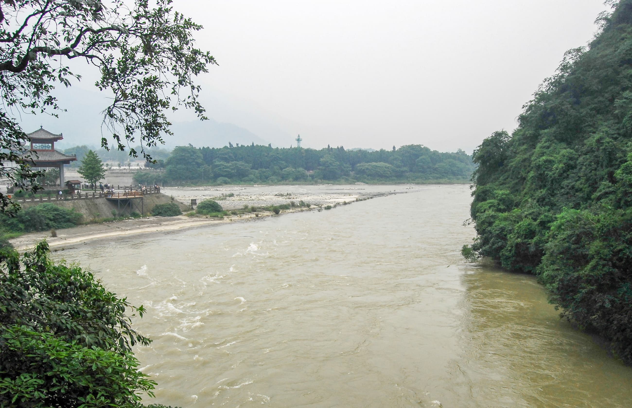
Baopingkou created a controlled entrance from the Inner River toward the plain. Seen from above, it can resemble an ordinary channel between banks. Its importance becomes clearer beside the rock of Lidui: ‘working with nature’ did not mean leaving the landscape untouched.
Rock was cut, channels formed, embankments raised and the river repeatedly managed. The achievement lies in the scale and placement of those interventions. Instead of one overwhelming obstruction, the system altered several critical points and allowed the current to connect them.
A Model Explains; the River Changes
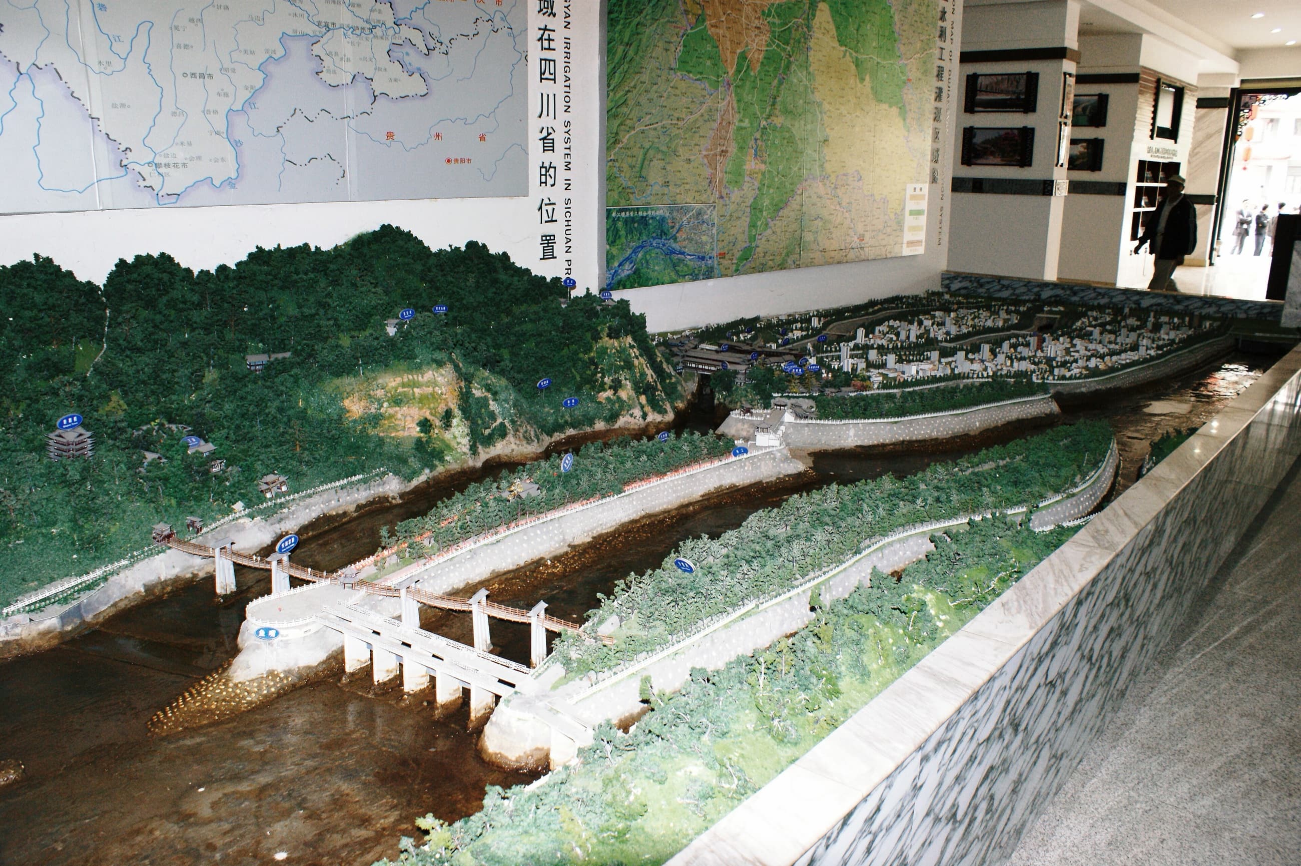
A physical model compresses the Fish Mouth, Feishayan and Bottle-Neck Passage into one view. It is an explanation, not an ancient artefact.
Then return to the water. At the Fish Mouth, look for the initial division. From higher viewpoints, trace the Inner River toward the narrower passage. Compare the smooth diagram with the moving, opaque and uneven current outside.
The difference between them is the story. The model presents a system; the river presents changing conditions. Dujiangyan exists in the effort to keep those two aligned.
Image: modern model of the irrigation system. Hugh Llewelyn / Wikimedia Commons, CC BY-SA 2.0; resized for web.
The Myth of the Self-Running Machine
Dujiangyan is sometimes described as though it were built once and then operated automatically for more than two thousand years. That version is memorable — and wrong.
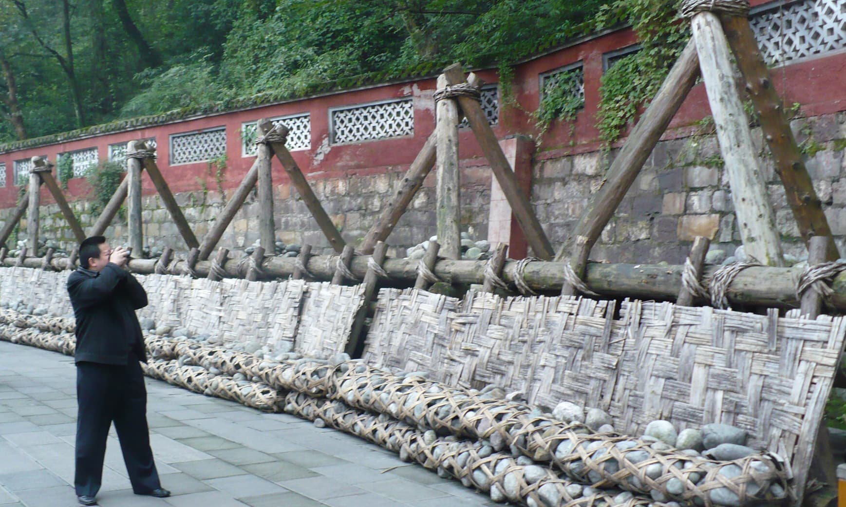
UNESCO records modifications and enlargements during the Tang, Song, Yuan and Ming dynasties. Historical forms included temporary low weirs and works made from materials designed to be repaired or replaced. The present system includes modern gates and control infrastructure.
A surviving principle is not an unchanged object. Channels do not reproduce every detail of 256 BCE, and the river has never remained fixed. The deeper continuity is methodological: generations kept the logic of diversion, release and controlled distribution while changing physical works around it. Dujiangyan survived because it could be rebuilt without losing purpose.
Survival Is a Maintenance Schedule
Moving water is never a finished material. It carries silt, presses against embankments and responds to rainfall upstream. Dujiangyan’s longevity depends on inspection, dredging, repair and institutional coordination. Channels must remain open; damaged works must be restored; distribution must respond to conditions rather than an ancient diagram treated as sacred.
Maintenance is often excluded from heroic engineering accounts because it has no single completion date. Here, it is the mechanism connecting Li Bing’s project to the present. The monument is not only earth, stone and water. It is a repeated public process: observe the river, repair what changed, preserve the relationships that make the system function.
The Plain Downstream
The headworks occupy one dramatic point, but effects spread across the Chengdu Plain. UNESCO’s current description states that the system irrigates 668,700 hectares and supports flood control, water transport and general water use. The figure reflects a present reporting scope, not the area served in antiquity.
Dujiangyan is ancient at its point of origin and cumulative in its reach. The river became a distributed resource because distribution itself was continually governed. Prosperity on the plain is not evidence that the river was conquered. It is evidence that a society built institutions able to negotiate with it for an unusually long time.
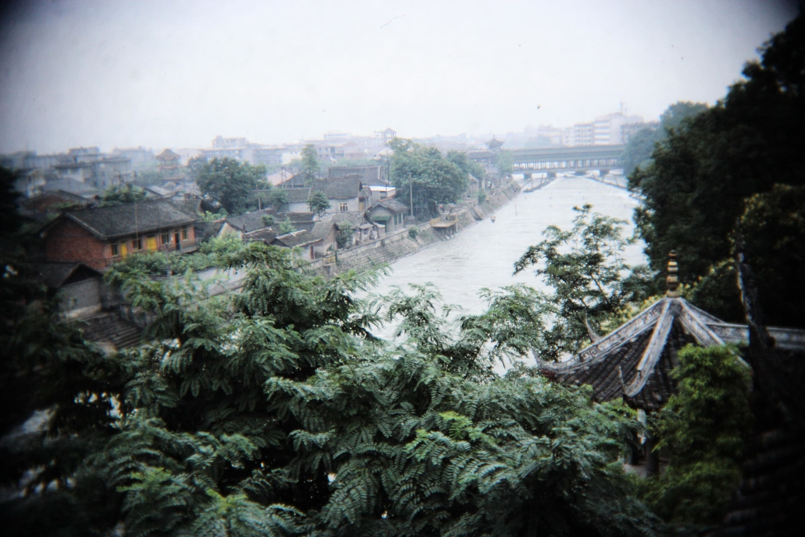
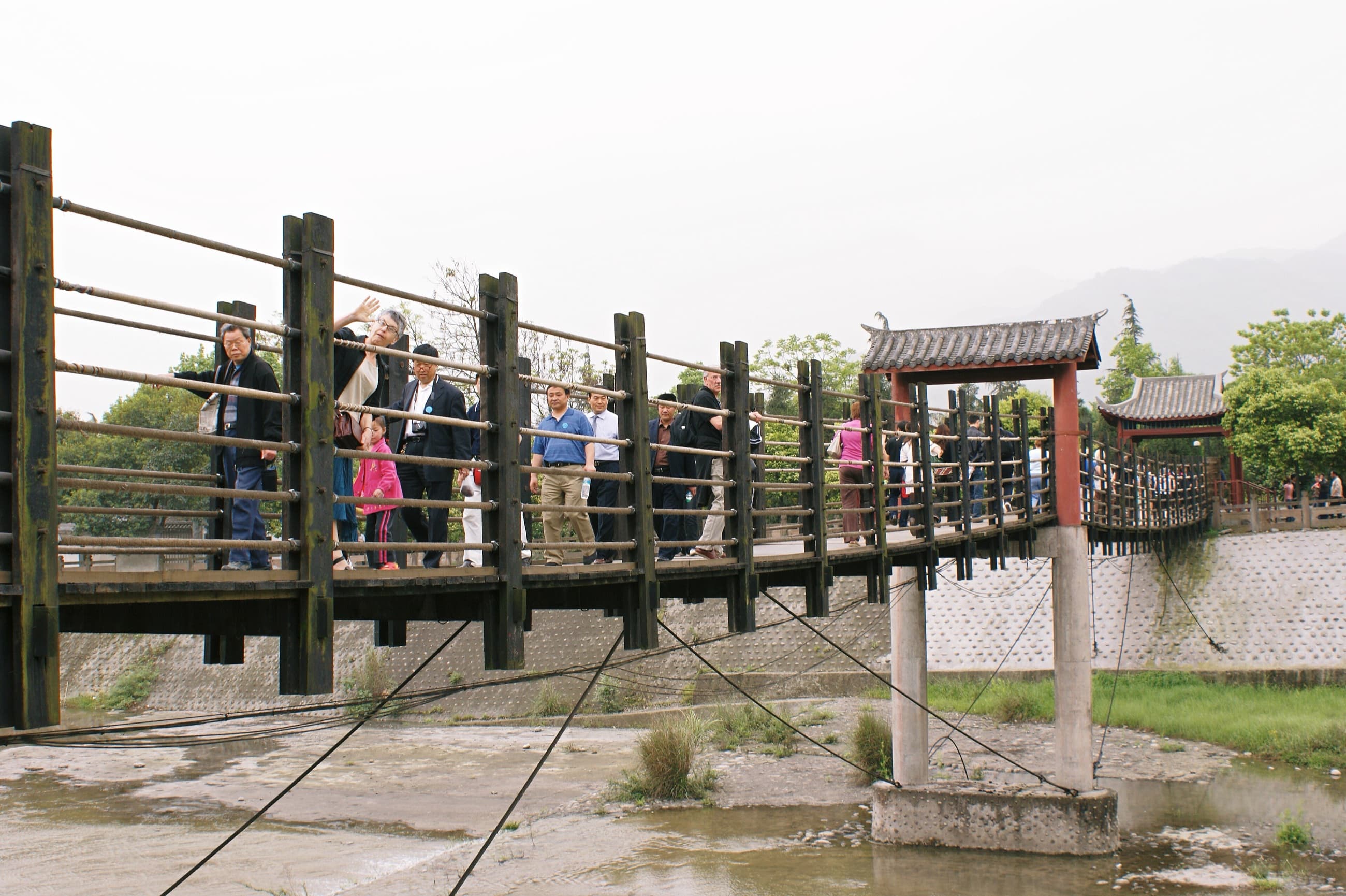
Image: Anlan Bridge and diversion area. Hugh Llewelyn / Wikimedia Commons, CC BY-SA 2.0; resized for web.
A Design and a Responsibility
Dujiangyan’s lesson is not that ancient engineers discovered a machine that never needed to change. It is almost the opposite: they established a way of organising change.
Every generation inherited both a design and a responsibility. Modern reservoirs, gates, urban demand, agriculture and ecological concerns alter the conditions again. Saving Dujiangyan cannot mean freezing the river in one imagined historical state. It means preserving the legibility and function of diversion, sediment management and shared governance while being honest about what has changed.